
Search
Wollongong
AreaNew South Wales
Wollongong
Area City
Showing the first 65 results out of a total 65
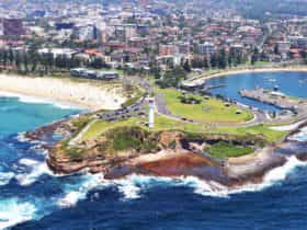
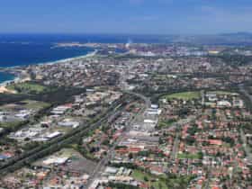
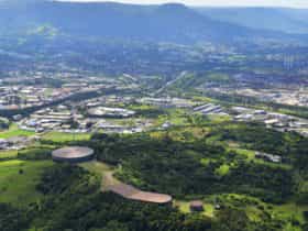
Wollongong
Urban CBDPopulation: 18442 | Wollongong
Wollongong is the third largest city in New South Wales and an hour's drive south of...
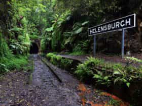
Helensburgh
UrbanPopulation: 6383 | Wollongong
Helensburgh is the northern most suburb of Wollongong, situated below the Royal National Park.Helensburgh is a...
Otford
UrbanPopulation: 369 | Wollongong
A small town in the Hacking River Valley, Otford is thought to be named after a...
Stanwell Park
UrbanPopulation: 1410 | Wollongong
Stanwell Park is a residential suburb, thought to be named after the villages of Stanwell on...
Stanwell Tops
UrbanPopulation: 495 | Wollongong
Stanwell Tops is a residential suburb in the north of Wollongong, named for being situated atop...
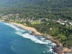
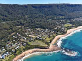
Austinmer
SuburbPopulation: 2560 | Wollongong
Austinmer is a northern beach suburb of Wollongong. It is thought to be named after Henry...
Balgownie
SuburbPopulation: 5525 | Wollongong
Bellambi
SuburbPopulation: 3947 | Wollongong
Berkeley
SuburbPopulation: 7605 | Wollongong
Berkeley is a suburb south of Wollongong that is mostly residential. Situated on the shore of...
Brownsville
SuburbPopulation: 534 | Wollongong
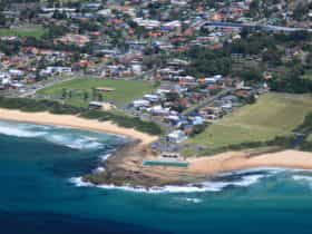
Bulli
SuburbPopulation: 6105 | Wollongong
Bulli is a residential seaside area near the northern end of suburban Wollongong. It extends to...
Clifton
SuburbPopulation: 28 | Wollongong
Clifton is an old coal-mining suburb in northern Wollongong. It is situated on a narrow area...
Coledale
SuburbPopulation: 1260 | Wollongong
Coniston
SuburbPopulation: 2268 | Wollongong
Cordeaux Heights
SuburbPopulation: 4559 | Wollongong
Cringila
SuburbPopulation: 2198 | Wollongong
Dombarton
SuburbPopulation: 146 | Wollongong
East Corrimal
SuburbPopulation: 3405 | Wollongong
Farmborough Heights
SuburbPopulation: 4198 | Wollongong
Fernhill
SuburbPopulation: 1023 | Wollongong
Figtree
SuburbPopulation: 11564 | Wollongong
Corrimal
SuburbPopulation: 6519 | Wollongong
A suburb of Wollongong, Corrimal was officially recorded as a place in 1839 when a grant...
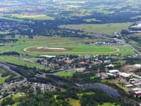
Dapto
SuburbPopulation: 10730 | Wollongong
Dapto is a developing residential area in southern Wollongong. It is famous for The Dapto Greyhound...
Fairy Meadow
SuburbPopulation: 7405 | Wollongong
Fairy Meadow is a suburb in the northwest of Wollongong. It's an established residential, institutional and...
Haywards Bay
SuburbPopulation: 1006 | Wollongong
Horsley
SuburbPopulation: 8221 | Wollongong
Kanahooka
SuburbPopulation: 5575 | Wollongong
Keiraville
SuburbPopulation: 3569 | Wollongong
Kembla Heights
SuburbPopulation: 119 | Wollongong
Koonawarra
SuburbPopulation: 3667 | Wollongong
Lake Heights
SuburbPopulation: 3845 | Wollongong
Mangerton
SuburbPopulation: 2859 | Wollongong
Gwynneville
SuburbPopulation: 3100 | Wollongong
Gwynneville is a suburb of Wollongong, located two kilometres west of Wollongong city centre. It is...
Kembla Grange
SuburbPopulation: 252 | Wollongong
Kembla Grange is a rural, residential and industrial area, with the residential area located mainly in...
Mount Ousley
SuburbPopulation: 1602 | Wollongong
Mount Pleasant
SuburbPopulation: 1370 | Wollongong
Mount St Thomas
SuburbPopulation: 1468 | Wollongong
North Wollongong
SuburbPopulation: 2608 | Wollongong
Primbee
SuburbPopulation: 1640 | Wollongong
Russell Vale
SuburbPopulation: 1547 | Wollongong
Spring Hill (Wollongong)
SuburbWollongong
Tarrawanna
SuburbPopulation: 2069 | Wollongong
Towradgi
SuburbPopulation: 3127 | Wollongong
Warrawong
SuburbPopulation: 4752 | Wollongong
West Wollongong
SuburbPopulation: 4827 | Wollongong
Yallah
SuburbPopulation: 138 | Wollongong
Mount Kembla
SuburbPopulation: 1068 | Wollongong
Mount Kembla is a residential area. Kembla is an Aboriginal word meaning "plenty of game". Kerosene...
Port Kembla
SuburbPopulation: 5014 | Wollongong
Port Kembla is approximately 10.5 kilometres south of central Wollongong and bounded on the east by...
Scarborough
SuburbPopulation: 308 | Wollongong
Scarborough is a suburb approximately 25 minutes north of Wollongong. Growth took place in the 1880s,...
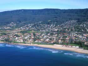
Thirroul
SuburbPopulation: 6083 | Wollongong
The English writer DH Lawrence lived in Thirroul in 1922 and wrote much of his Australian...
Unanderra
SuburbPopulation: 5434 | Wollongong
Unanderra is bounded by the Unanderra railway line, the suburbs of Farmborough Heights and Figtree to...
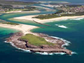
Windang
SuburbPopulation: 2656 | Wollongong
Windang, which takes its name from an Aboriginal word meaning 'scene of a flight', is a...
Wombarra
SuburbPopulation: 872 | Wollongong
The rural and residential suburb of Wombarra is 20 kilometres north of Wollongong, and gets its...
Woonona
SuburbPopulation: 12187 | Wollongong
The suburb of Woonona was developed post-war and is still experiencing growth. The name is thought...
Avondale
RuralPopulation: 1653 | Wollongong
Cleveland
RuralPopulation: 21 | Wollongong
Cordeaux
RuralWollongong
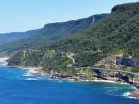
Coalcliff
RuralPopulation: 189 | Wollongong
Coalcliff is a suburb of northern Wollongong at the base of the Illawarra escarpment, founded in...
Darkes Forest
RuralPopulation: 115 | Wollongong
Darkes Forest is a semi rural area on top of the Illawarra Escarpment. Traditionally the land...
Huntley (Wollongong)
RuralPopulation: 50 | Wollongong
Lilyvale
RuralPopulation: 5 | Wollongong
Maddens Plains
RuralPopulation: 4 | Wollongong
Marshall Mount
RuralPopulation: 142 | Wollongong
Mount Keira
RuralPopulation: 1665 | Wollongong
Mount Keira is residential suburb that envelops the mountain to the west of Wollongong city. Its...
Wongawilli
RuralPopulation: 141 | Wollongong
Showing the first 65 results out of a total 65